Table of Contents
Checking Aviation Weather
The NAV Canada Collaborative Flight Planning Services website is an online tool which offers services which can help you prepare for flight. This article will go over how to use the CFPS site to look at aviation weather in the form of TAFs, METARs and Graphical Area Forecasts. For information on how to use the CFPS site to look at NOTAMs visit this link.
TAFs and METARs
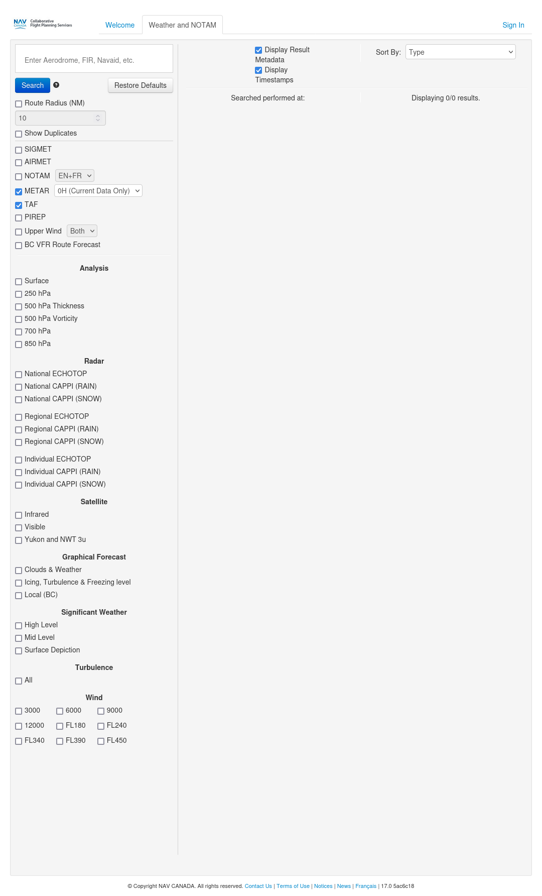
To only check the METARs and TAF, ensure that all of the other checkboxes are unchecked as shown below:
You can get the aviation weather for a single airfield, a radius around an airfield, or between multiple airfields. However, if the airfield in question does not have weather services, then no results will be returned unless you also define a route radius that is large enough to encompass a nearby airfield which does have weather services.
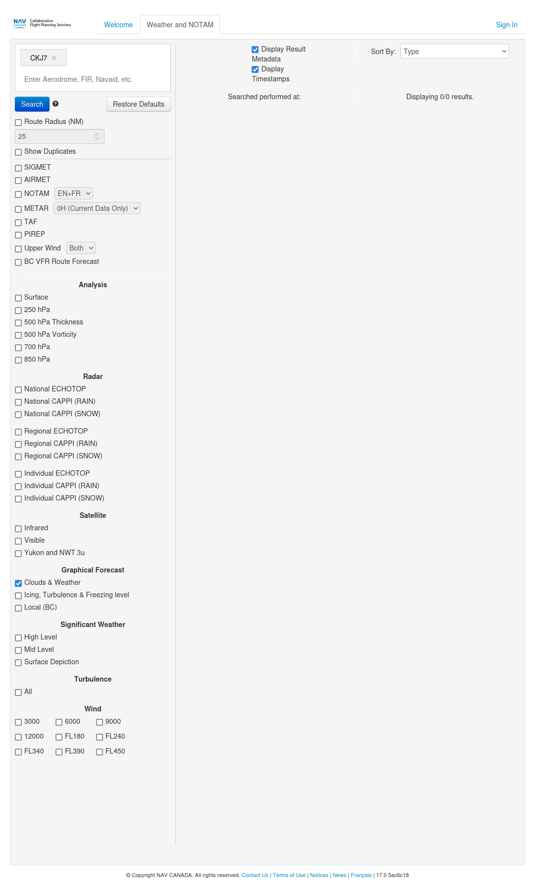
The Starbuck (CKJ7) airfield does not have weather services and no results will be returned if you just put CKJ7 into the Aerodrome, FIR, Navaid, etc. text box.
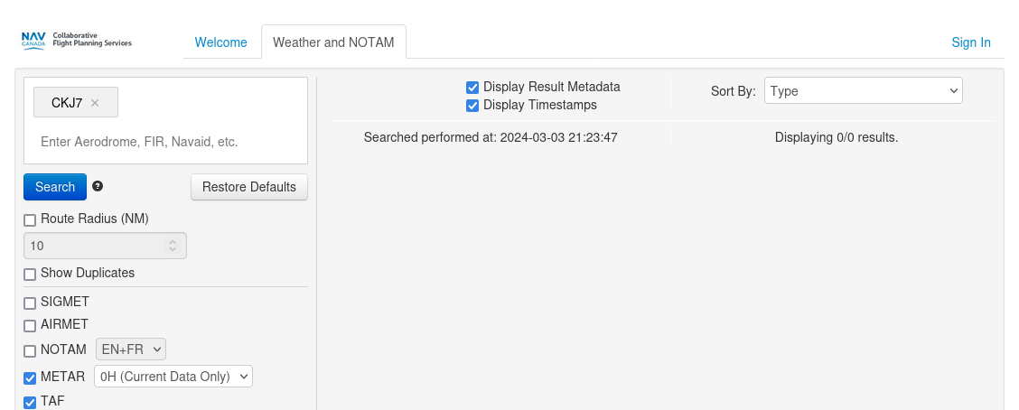 (Please note that I only show as much of page as required to illustrate a concept.)
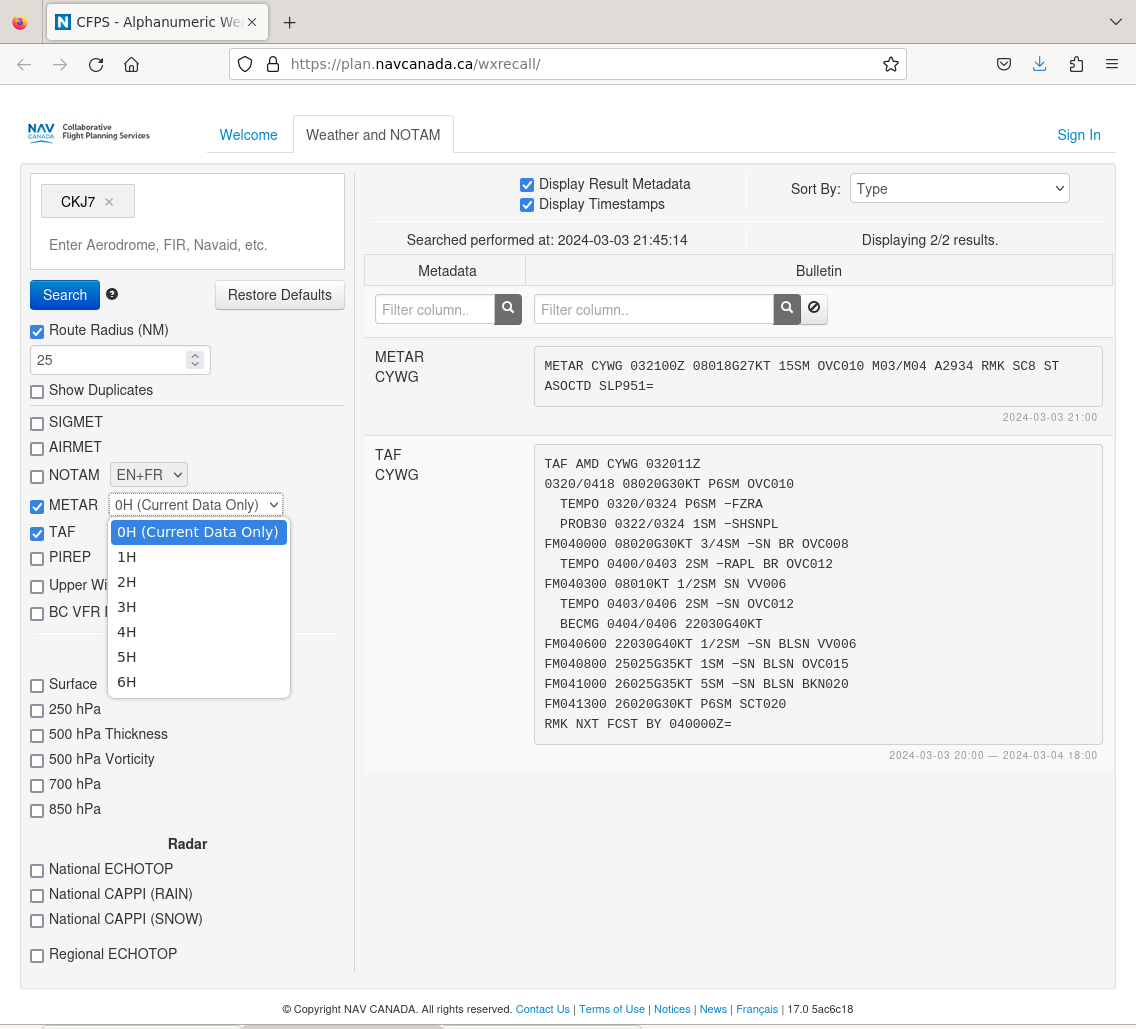
However, if you put in a route radius of 25 NM, you will then pick up the TAF and METARs for Winnipeg (CYWG).
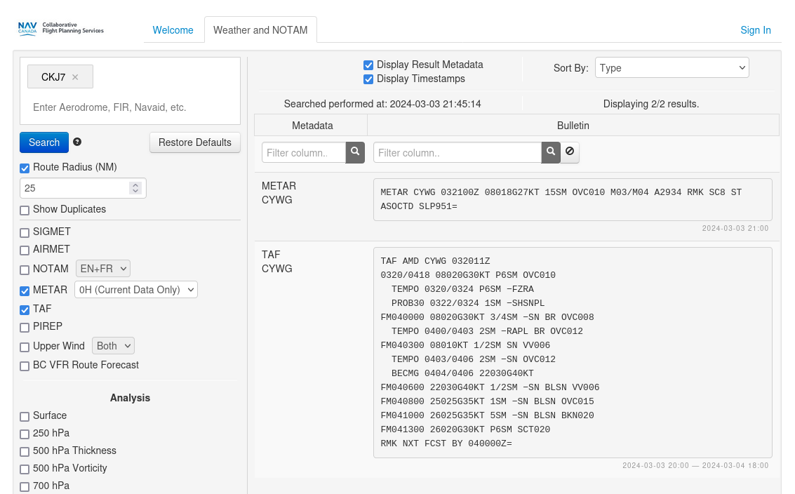
You may have noticed that the METAR field has a drop down box with 0H (Current data only) displayed. If you wish to view prior METARs, you can pick the appropriate choice depending upon how far you wish to go back in time. You can grab up to 6 prior METARs.
Lastly, you may get the METARs and TAFs for multiple airfields by entering the airfields into the Aerodrome, FIR, Navaid, etc. text box.
- If you do not enter a Route Radius then you will only get the TAFs and METARs for the airfields in the the Aerodrome, FIR, Navaid, etc. text box which have weather services. No route radius example.
- If you have entered a Route Radius then will get the TAFs and METARs for all airfields with weather services encompassed by the route radius between the airfields listed in the Aerodrome, FIR, Navaid, etc. text box. Example with a route radius.
Graphical Area Forecasts
Graphical area forecasts are also available NavCanada Collaborative Flight Planning Services website. Scroll down to the Graphical Forecast section of the left side menu bar and check the Clouds & Weather checkbox. Enter at least one airfield into the Aerodrome, FIR, Navaid, etc. text box.
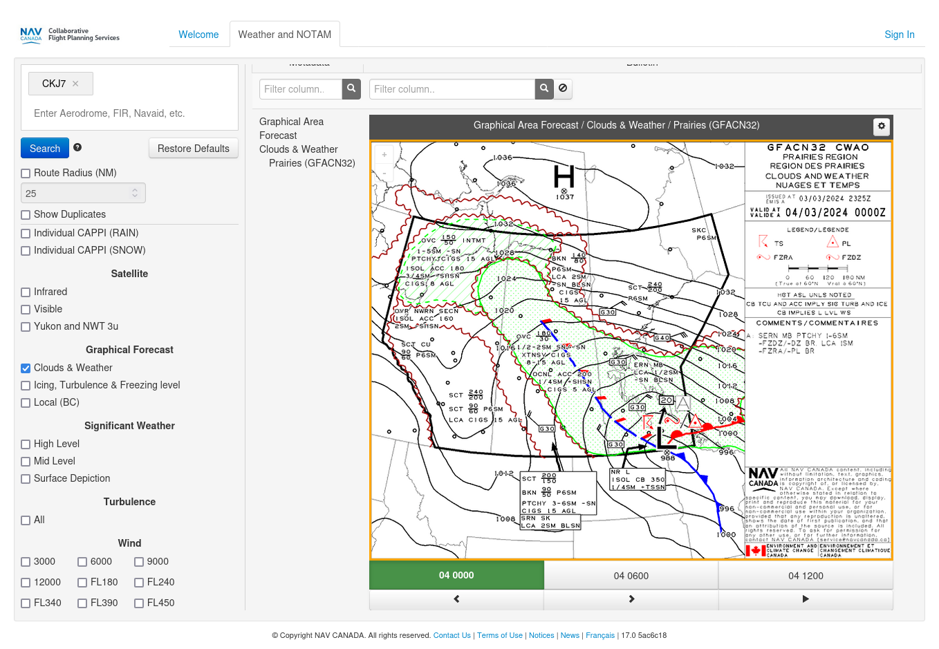
Regardless of whether or not the airfield(s) entered has(have) weather services, the Graphical Area Forecast will be returned for the region to which the airfield belongs.
While only one graphical area forecast image is displayed at one time, you can cycle through the current forecast image as well as the next two forecast images by pressing the “<”, “>” or play buttons underneath the image.
Useful links:
- Aviation Weather Services Guide (https://www.navcanada.ca/en/aviation-weather-services-guide.pdf)
- List of Manitoba airports (https://skyvector.com/airports/Canada/Manitoba).
- Manual of Abbreviations (https://www.canada.ca/content/dam/eccc/migration/main/manab/ff340370-81d3-4b5d-a2c1-e25ac6342937/manab.pdf).
- TC AIM MET—METEOROLOGY (https://tc.canada.ca/sites/default/files/2020-10/aim-2020-2_met-e.pdf)
