Radio Frequencies Near Our Club
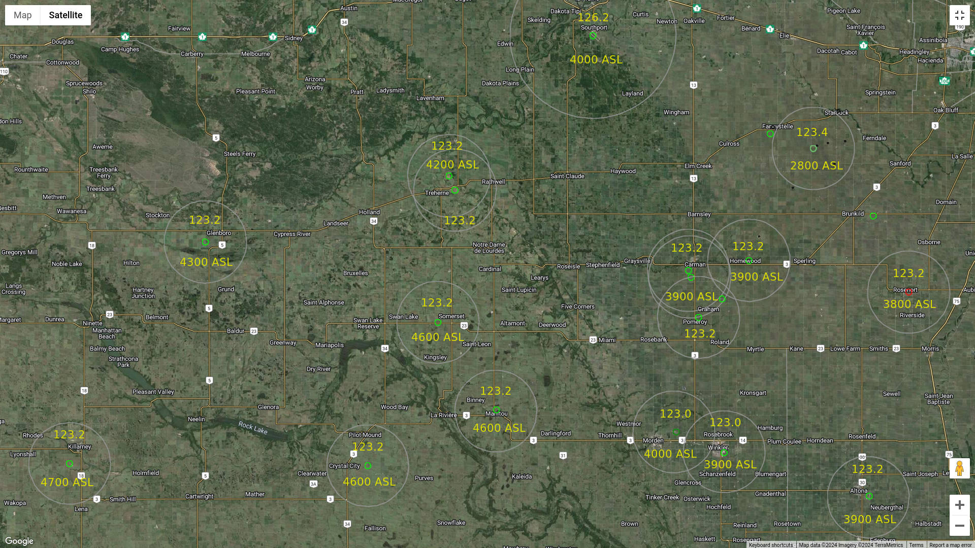
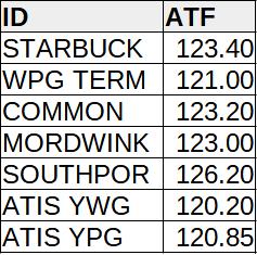
The attached image shows the airport radio frequencies for most of the airports near our club. The gray circles show the “zone” around the airport for which the frequency applies. The height shown within the gray circle shows the height to which the radio frequency extends. Most of the “zones” are 5 NM around the airport with the exception of Southport which is 10 NM.
NB: There may be missing airports and this information on this page may be out of date.
The diagram was created by using the circle drawing tool at the mapdevelopers.com website to draw the circles. Once all of the circles were drawn, an image was saved and then edited with an image editing tool (gimp) to add the frequencies and elevations. If you wish to view the image on the mapdevelopers website, go to this link to do so. Going to the link will allow you to zoom in or out on the map.


